


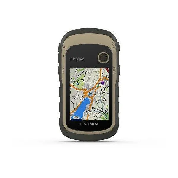

Garmin eTrex 32x
Description
Reliable Outdoor Navigation
The eTrex 32x is designed to provide accurate positioning in environments where mobile phones may lose signal or become difficult to rely on. By supporting both GPS and GLONASS satellite constellations, it maintains reliable positioning in forests, valleys, and other areas where satellite visibility can be limited.
Preloaded TopoActive maps include routable roads and trails for hiking and cycling, while the expandable memory allows additional compatible maps to be installed as your adventures take you to new locations.
Built for the Outdoors
The eTrex series has earned a long-standing reputation for durability, and the 32x continues that tradition. Its compact housing is IPX7 water resistant and designed to withstand rain, splashes, and everyday outdoor use. Physical buttons make operation simple while wearing gloves or in wet weather, and the sunlight-readable 2.2-inch color display remains easy to view in bright outdoor conditions.
Powered by two AA batteries, the device offers up to 25 hours of runtime, making it practical for multi-day hikes, hunting trips, and field work where charging opportunities are limited.
Advanced Navigation Features
The eTrex 32x includes several navigation tools that go beyond basic GPS positioning. A built-in 3-axis electronic compass provides accurate heading information while standing still, and the barometric altimeter helps monitor elevation changes throughout your journey.
Additional capabilities include support for BirdsEye Satellite Imagery, paperless geocaching, waypoint and route management, and wireless ANT+ connectivity for compatible Garmin accessories and sensors. These features make the device suitable for both casual outdoor recreation and more demanding navigation tasks.
Designed for a Wide Range of Activities
The Garmin eTrex 32x is suitable for a variety of outdoor adventures and professional applications, including:
- Hiking and backpacking
- Hunting and fishing
- Geocaching
- Cycling and bikepacking
- Search and rescue
- Forestry and land management
- Surveying and field inspections
- Off-road navigation
Its simple operation, dependable battery life, and rugged design continue to make it a practical navigation tool for users who value dedicated handheld GPS devices.
Features
- GPS and GLONASS support
- Preloaded TopoActive maps
- 3-axis electronic compass
- Barometric altimeter
- 25-hour battery life
- BirdsEye imagery support
- IPX7 water resistant
- Expandable map storage
Package
Garmin eTrex 32x Includes:
- Garmin eTrex 32x handheld GPS
- USB cable
- Documentation
Technical Specifications
Display
- 2.2-inch sunlight-readable color display
- 240 × 320 pixels
- 65K-color transflective TFT
Dimensions
- 2.1 × 4.0 × 1.3 in (5.4 × 10.3 × 3.3 cm)
Weight
- 5.0 oz (141.7 g) with batteries
Durability
- IPX7 water resistant
Included
- Preloaded TopoActive maps
- 3-axis electronic compass
- Barometric altimeter
- BirdsEye Satellite Imagery compatible
- Paperless geocaching
- Automatic routing (with compatible maps)
- Waypoints: 2,000
- Routes: 200
- Track log: 10,000 points
- Saved tracks: 200
Battery
- 2 × AA batteries (NiMH or Lithium recommended)
- Up to 25 hours battery life
Additional
- Garmin Explore™ compatible
- Custom maps support
- Area calculation
- Sun and moon information
- Hunt and fish calendar
- Compatible with Garmin mounts and accessories
Data Network
- GPS
- GLONASS
- High-sensitivity receiver
Memory
- 8 GB internal memory
- microSD™ card slot
- Supports additional downloadable maps
Interfaces
- USB
- ANT+
- microSD card slot
