The Satellite Phone Store
The best place to shop for reliable satellite equipment for remote work, travel, emergency response, and off-grid operations, and more.


Best Sellers


Our Most Popular Offers


Compare Top Satellite Devices
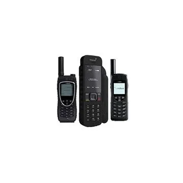
 Thuraya X5-TOUCH
| Inmarsat IsatPhone 2 | Iridium 9555 | Iridium Extreme 9575 | Thuraya X5-TOUCH | |
|---|---|---|---|---|
| Network | Inmarsat | Iridium | Iridium | Thuraya |
| Coverage | Near-global coverage (excludes polar regions) | Truly global coverage (including poles, oceans, and air routes) | Truly global coverage (including poles, oceans, and air routes) | Regional coverage (Europe, Africa, Asia, and parts of the Middle East) |
| Battery | 8h Talk/160h stand by | 4h Talk/30h stand by | 4h Talk/30h stand by | 9h Talk/100h stand by |
| Size | 6.7" x 3" | 5.63" x 2.17" | 5.5" x 2.3" | 5.7" x 3" |
| Durability | -20°C +55°C IP65 | -20°C +55°C | -20°C +55°C IP65 | -20°C +55°C IP67 |
| Water Res. | Jet water | Limited | Jet water | Jet water |
| SOS | ||||
| GPS | ||||
| Handsfree | ||||
| Bluetooth | × | × | ||
| Camera | × | × | × | |
| Summary | Rugged, dependable satellite phone featuring GPS, SOS alerting, and exceptional battery life for off-grid communication. | Compact and trusted satellite phone delivering consistent global voice and SMS connectivity. | Hardened satellite phone with GPS tracking, SOS functionality, and military-grade build quality for mission-critical use. | An Android-based satellite smartphone offering GPS, SOS, and seamless switching between satellite and GSM networks. |
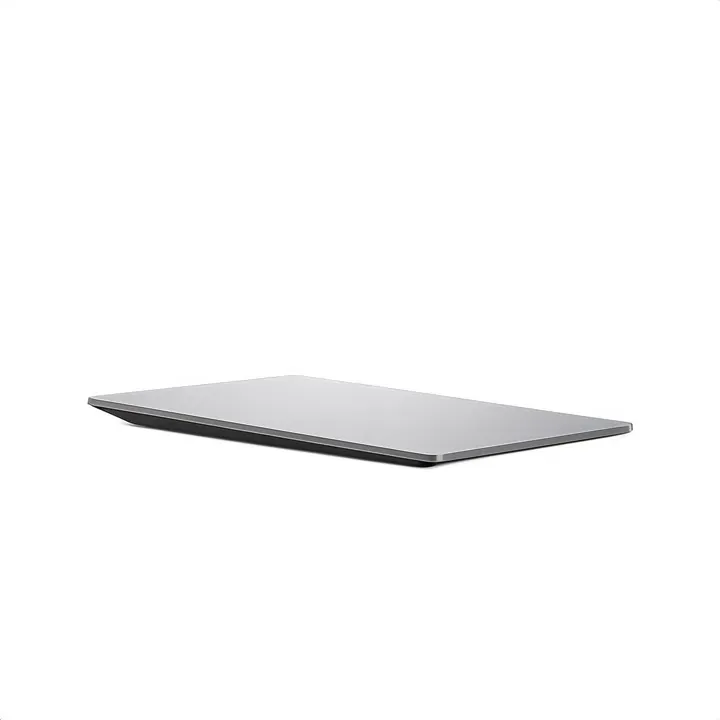
 Starlink Mini
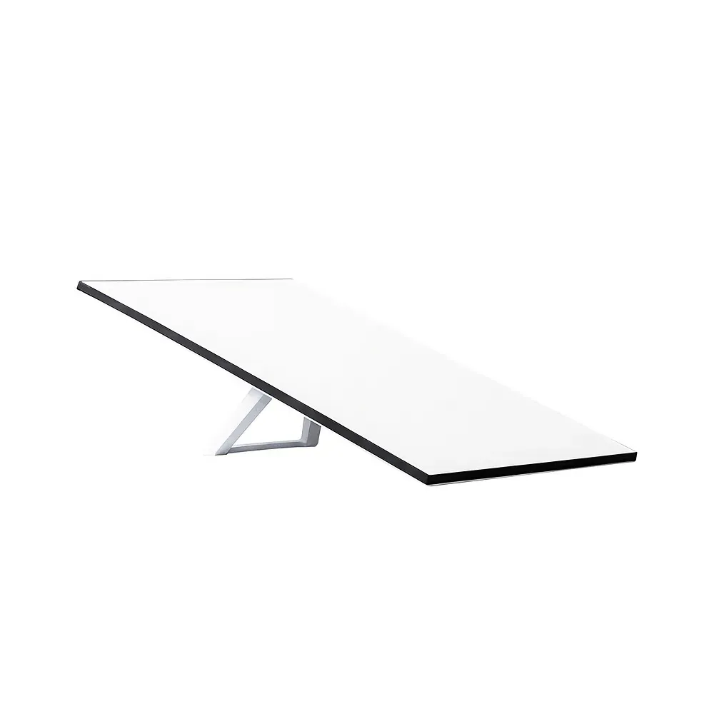
 Starlink Standard
 Starlink Performance
| Starlink Mini | Starlink Standard | Starlink Performance | |
|---|---|---|---|
| Upload Speed | 5-20 Mbps | 5-20 Mbps | 8-25+ Mbps |
| Latency (On Land) | 25-60 ms | 25-50 ms | 25-50 ms |
| Dimensions | 11.75" × 10.2" × 1.45" | 23.4" × 15.07" × 1.5" | 24" × 15.6" × 1.6" |
| Weight | 2.43 lbs (1.1 kg) | 7.9 lbs (3.6 kg) | 11.5 lbs (5.2 kg) |
| Power Consumption | 25-40W | 75-100W | 75-100W |
| Connection Support | Up to 128 devices | Up to 235 devices | Depends on external router |
| Field of View | 110° | 110° | 140° |
| Operating Temperature | -22°F to 122°F (-30°C to 50°C) | -22°F to 122°F (-30°C to 50°C) | -40°F to 140°F (-40°C to 60°C) |
| Environmental Rating | IP67 Type 4 | IP67 Type 4 | IP69K / IP68 |
| Snow Melting | Up to 1" / hour (25mm / hour) | Up to 1.5" / hour (40mm / hour) | Up to 3.5" / hour (85mm / hour) |
| Wind Resistance | Operational: 60+ mph (96+ kph) | Operational: 60+ mph (96+ kph) | Survivable: 174+ mph (280+ kph) |
| Orientation | Software Assisted Manual Orienting | Software Assisted Manual Orienting | Software Assisted Manual Orienting |
| Summary | Lightweight and portable terminal designed for fast setup and reliable connectivity in mobile or short-term deployments. | Well-balanced terminal offering consistent performance and flexibility for stationary operations with light mobility needs. | Rugged, high-capacity terminal built for reliability and uptime in challenging conditions and bandwidth-intensive operations. |
Satellite Phones
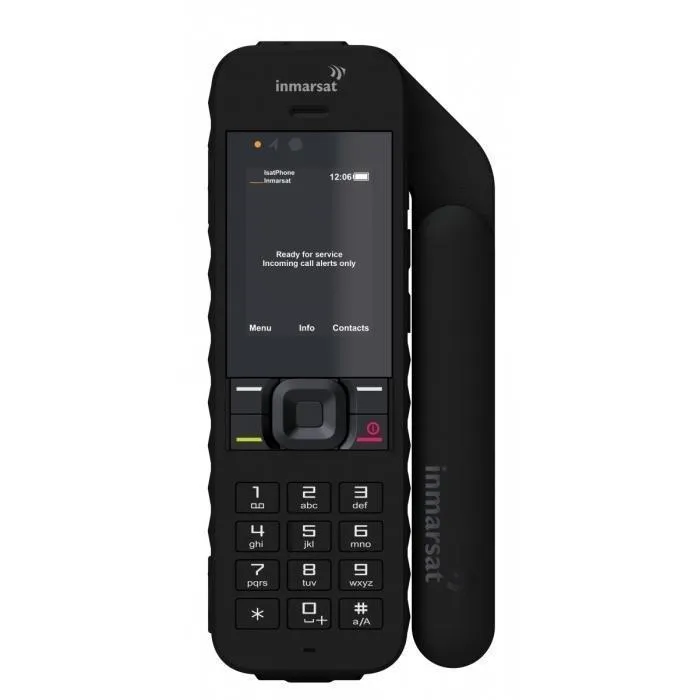
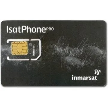
Inmarsat IsatPhone 2 Satellite Phone
Dependable satellite connection for clear skies, when cellular fails & privacy is key.
Inmarsat IsatPhone 2 Satellite Phone
Stay connected in remote locations with the Inmarsat IsatPhone 2, a dependable satellite phone designed for real-world field use. Enjoy clear voice calls and SMS messaging over the Inmarsat satellite network, providing stable, near-global coverage. With up to 8 hours of talk time and 160 hours of standby, it is ideal for extended deployments, emergency response, maritime operations, and remote travel.

Iridium 9555 Satellite Phone
Robust connectivity in varying conditions, when reliability & secure access are needed most.
Iridium 9555 Satellite Phone
The Iridium 9555 is a reliable satellite phone built for operations where cellular networks do not exist. It provides voice calling and SMS messaging anywhere on Earth using the Iridium satellite network, including oceans, mountains, and polar regions. Designed for durability and ease of use, the 9555 features a rugged housing, simple interface, and internally stowed antenna for portability.
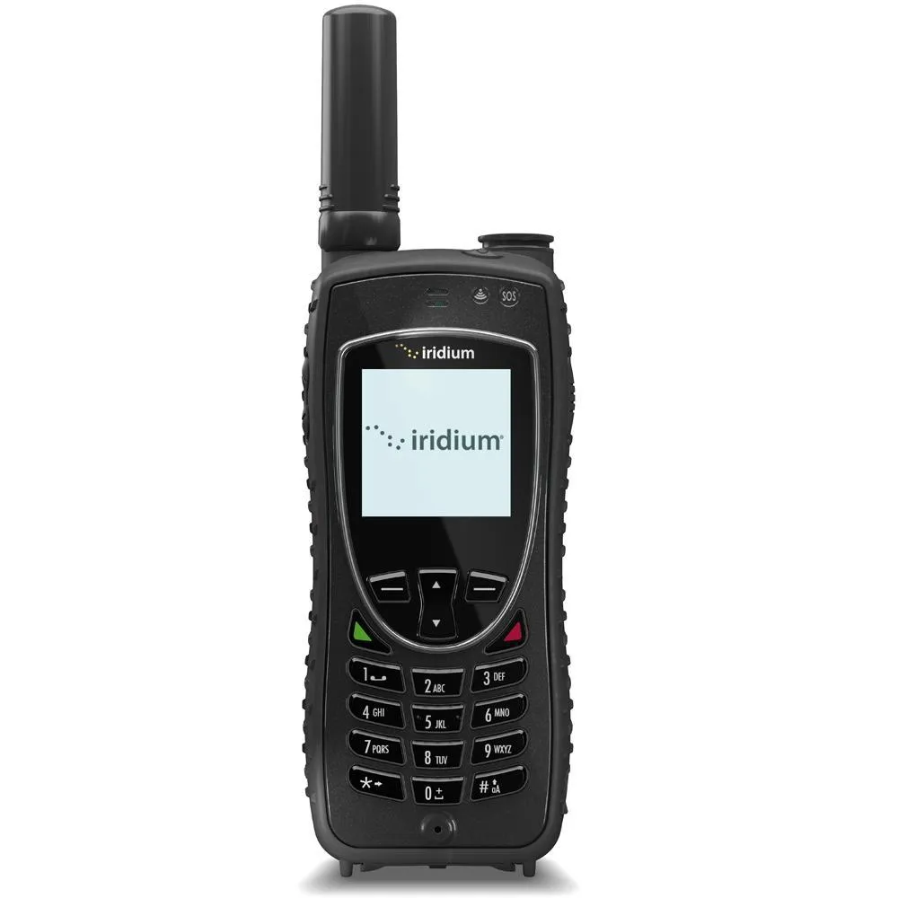
Iridium Extreme 9575 Satellite Phone
Most durable & reliable connectivity with an emergency SOS, for secure & critical communication.
Iridium Extreme 9575 Satellite Phone
The Iridium Extreme 9575 is built for mission-critical communication in the toughest environments. It combines true global voice and text coverage with military-grade durability, ensuring reliable performance anywhere on the planet. The phone includes integrated GPS tracking, location sharing, and a programmable one-touch SOS button for emergency alerting. The Iridium Extreme is ideal for emergency responders, remote field teams, maritime operations, and high-risk travel.
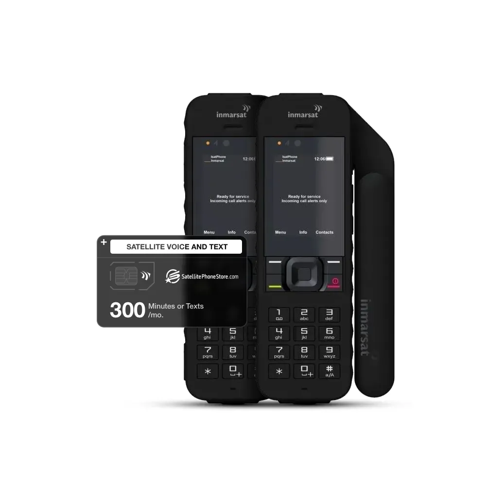
Inmarsat IsatPhone Dual Phone Bundle
Essential, clear-sky satellite connection for two, with secure shared minutes for privacy.
Inmarsat IsatPhone Dual Phone Bundle
Designed for pairs who prioritize secure, dependable communication, this bundle provides 300 shared minutes to ensure you stay connected across near-global coverage. Whether for coordinated efforts or personal peace of mind, it's an essential solution for those who value privacy and reliability in remote areas.
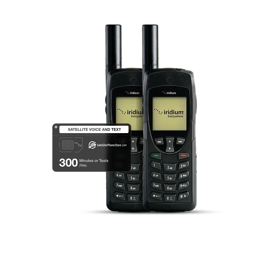
Iridium 9555 Dual Phone bundle
Reliable, secure communication for two, designed to withstand tough & varied conditions.
Iridium 9555 Dual Phone bundle
Designed for duos needing resilient communication, this bundle provides two Iridium 9555 devices with 300 shared minutes, ensuring reliable global connectivity across challenging, unpredictable terrain. Ideal for secure, dependable access in demanding environments.
High-Speed Satellite Internet
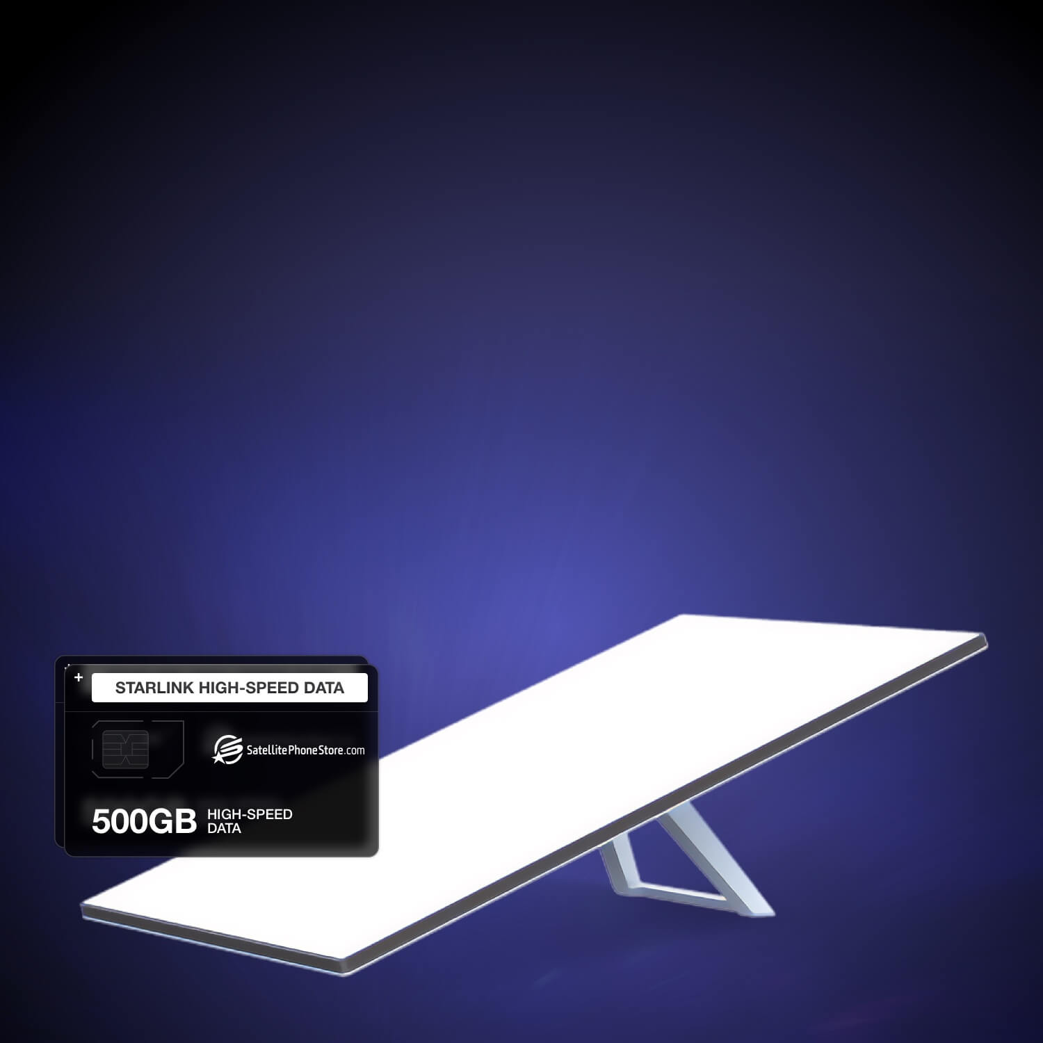
Starlink Standard
Reliable high-speed internet for fixed or temporary sites, when broadband performance & continuity matter.
Starlink Standard
Starlink Standard Kit delivers high-speed, low-latency satellite internet for locations where traditional networks are unavailable or unreliable. Designed for stationary or temporary installations, it provides consistent broadband performance suitable for data transfers, backup connectivity, and critical operations. Simple installation and dependable performance make it an effective solution for teams that need stable internet access beyond cellular coverage in professional, industrial, and field environments.

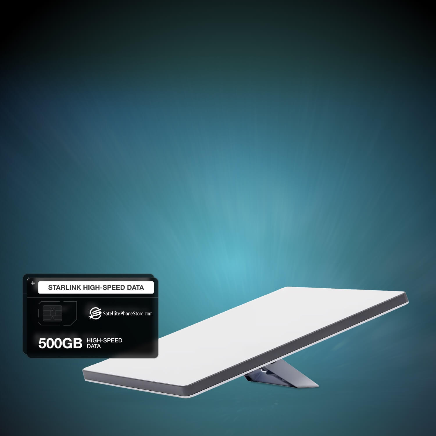
Starlink Mini
Portable high-speed satellite internet for rapid deployment, when mobility & low power use are essential.
Starlink Mini
The Starlink Mini provides fast, low-latency satellite internet in a compact and lightweight design built for mobile and off-grid use. It delivers broadband connectivity within minutes, enabling reliable communication in remote areas. With an integrated antenna, modem, and WiFi 6 router, the Mini is easy to transport and deploy. Its low power consumption supports battery and solar operation, making it well suited for field teams, emergency response, temporary command centers, and mobile operations that require dependable internet on the move.
Starlink Performance
Enterprise-grade satellite internet for extreme conditions, when maximum speed & resilience are required.
Starlink Performance
Starlink Performance Gen 3 is built for mission-critical connectivity in the most demanding environments. It delivers ultra-fast, low-latency satellite internet with download speeds exceeding 400 Mbps, supporting data-intensive operations where failure is not an option. Designed for fixed or in-motion installations, it is ideal for disaster response, maritime operations, remote industry, and high-reliability deployments requiring enterprise-level performance.

Hughes HL1120W OneWeb
Rugged high-speed LEO broadband for remote and fixed sites, where reliable global connectivity matters.
Hughes HL1120W OneWeb
The Hughes HL1120W OneWeb User Terminal delivers fast, low-latency internet over OneWeb’s LEO satellite network for professional and industrial deployments. Its electronically steered, self-aligning antenna provides full-duplex connectivity with no moving parts, while the rugged aluminum design operates reliably from -40°C to +55°C. With up to 195 Mbps download speeds, efficient power use, and simple out-of-box installation, it’s built for demanding environments beyond terrestrial networks.

Intellian OW10HL OneWeb User Terminal
Compact, SWaP-optimized LEO connectivity for enterprise and community broadband deployments.
Intellian OW10HL OneWeb User Terminal
The Intellian OW10HL is a low-profile OneWeb user terminal designed for reliable fixed-site broadband in remote locations. Its flat-panel antenna delivers stable performance and smooth satellite handovers, even at low elevation angles. A single-cable indoor/outdoor design simplifies installation, while rugged construction and -40°C operation ensure dependable service for enterprise, government, and community networks.
Faraday Bags

Satellite Phone Faraday Bag
Signal-blocking protection for satellite phones and mobile devices, when privacy and security matter most.
Satellite Phone Faraday Bag
The EscapeZone Satellite Phone Faraday Bag creates a secure barrier that blocks all wireless signals, including cellular, GPS, WiFi, Bluetooth, and RFID. Built from high-quality conductive materials, it protects devices from tracking, hacking, and unauthorized access while also providing shielding against EMPs and solar events. Lightweight and portable, it fits easily in a pocket or bag and is designed in the USA for everyday carry, travel, and disaster preparedness.

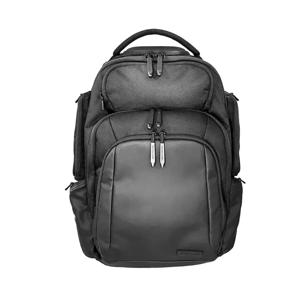
Shield Faraday Ballistic Backpack
Combined digital signal shielding and ballistic protection, for discreet everyday carry in high-risk environments.
Shield Faraday Ballistic Backpack
The EscapeZone Shield Faraday Ballistic Backpack integrates built-in Faraday pockets to block all wireless signals with NIJ Level 2A ballistic resistance for added physical protection. Designed for global use, it features a lightweight, weather-resistant build with ample storage for electronics, travel gear, and essentials. Trusted by military and law enforcement, it offers optional armor plate upgrades while maintaining a low-profile, practical design for daily or travel use.

Heavy Duty Faraday Duffle Bag
Large-format EMP and signal shielding for electronics, power equipment, and emergency gear.
Heavy Duty Faraday Duffle Bag
The EscapeZone Heavy Duty Faraday Duffle Bag is built to protect larger electronics and equipment from wireless intrusion, EMPs, and cyber threats. Its triple-layer Faraday lining blocks Wi-Fi, Bluetooth, GPS, RFID, and cellular signals, while the rugged vinyl exterior withstands harsh conditions. Designed for grab-and-go readiness, it offers spacious storage, reinforced construction, and discreet styling for emergency response, off-grid operations, and secure transport.
Dual Protection Faraday Ballistic Backpack
Integrated digital signal shielding and ballistic protection, for high-risk travel and daily carry.
Dual Protection Faraday Ballistic Backpack
The EscapeZone Dual Protection Faraday Ballistic Backpack combines built-in Faraday pockets with enhanced ballistic protection to safeguard both your devices and yourself. Multiple internal Faraday compartments block all wireless signals for phones, tablets, laptops, and key fobs, while durable, water- and dust-resistant materials protect gear in harsh conditions. With organized storage, quick-access pockets, and a discreet profile, it’s built for security-focused professionals and demanding environments.
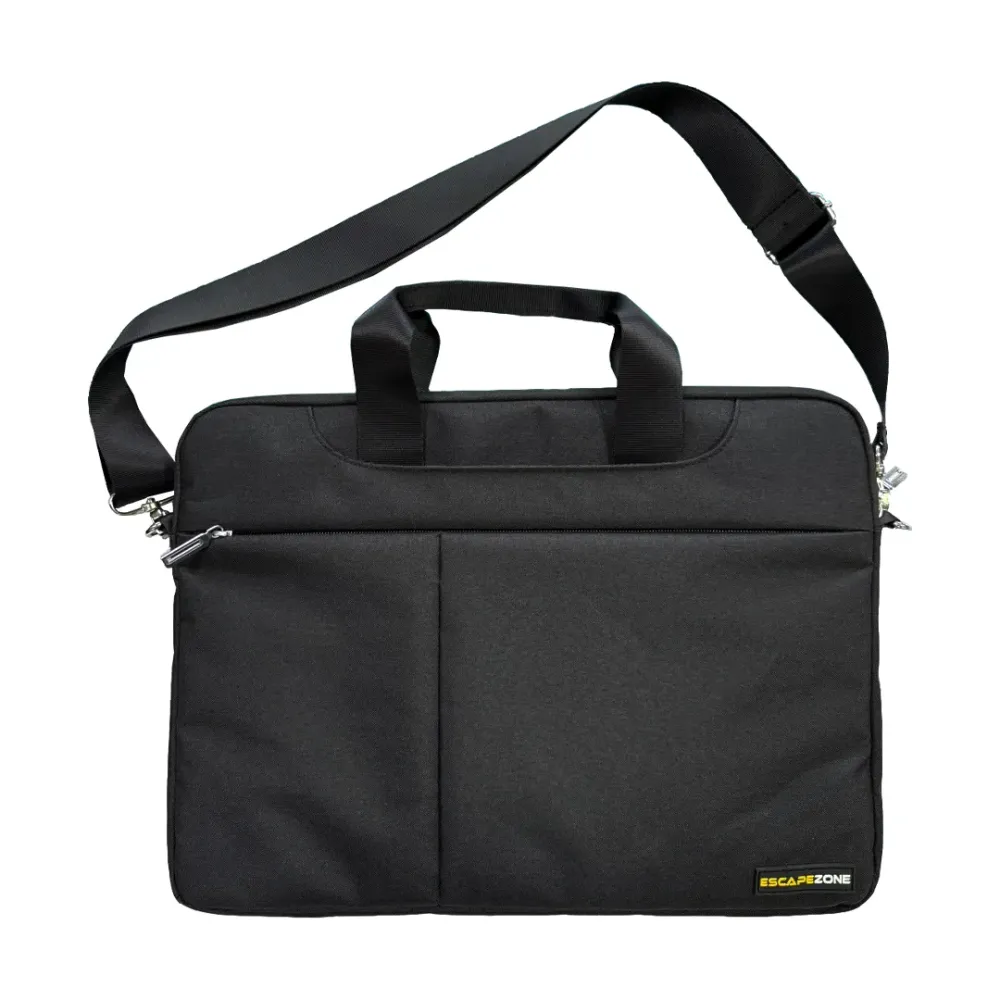
Laptop Faraday Shoulder Bag
Everyday laptop protection with full signal blocking for privacy-focused professionals.
Laptop Faraday Shoulder Bag
The EscapeZone Laptop Faraday Shoulder Bag features a built-in Faraday compartment that blocks cellular, WiFi, Bluetooth, GPS, and other wireless signals to protect devices from tracking and hacking. Designed to fit laptops up to 17 inches, it pairs weather-resistant construction with a comfortable over-the-shoulder design, making it ideal for daily commutes, travel, and secure mobile work.
EcoFlow Power Solutions
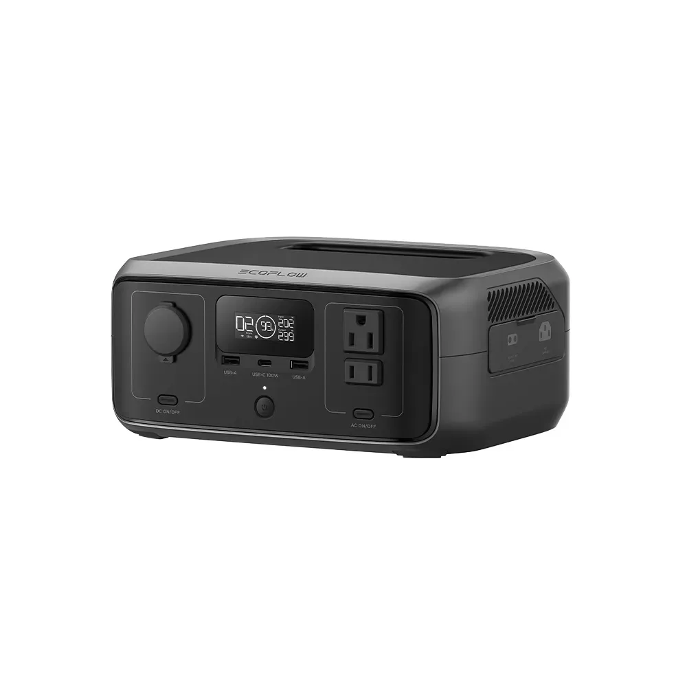
EcoFlow RIVER 3
Compact, fast-charging portable power for travel, outdoor use, and essential backup.
EcoFlow RIVER 3
The EcoFlow RIVER 3 provides 245Wh of portable power with a 300W output (600W X-Boost) for phones, laptops, cameras, and small appliances on the move. It recharges in about 1 hour and stays quiet while running. With <20 ms UPS protection, it also supports short home outages for essentials. Lightweight and easy to pack, it's a dependable power source for everyday carry, camping, or quick backup at home.
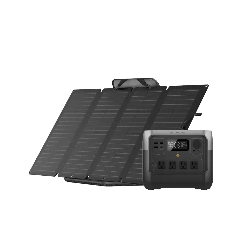
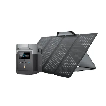
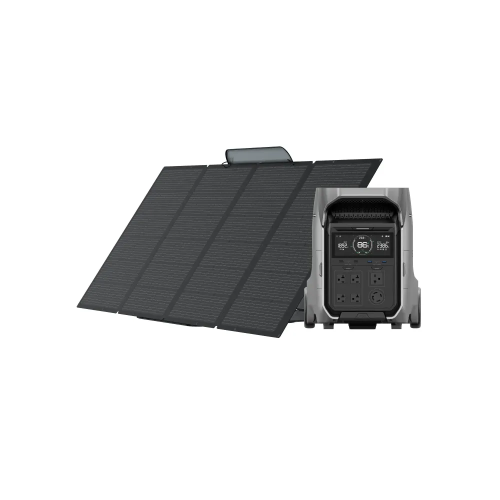
EcoFlow RIVER 2 Pro with 160W Solar Panel
Portable power with renewable solar charging for travel, camping, and essential backup.
EcoFlow RIVER 2 Pro with 160W Solar Panel
This bundle pairs the 768Wh RIVER 2 Pro with a 160W portable solar panel for reliable power on the move. The 800W output runs small appliances, tools, and camping essentials, while the solar panel keeps the system charged when you're off-grid. It recharges from AC in about 70 minutes and uses long-life LFP batteries built for daily use. Perfect for RVing, outdoor setups, and short-term emergency power when the grid goes down.
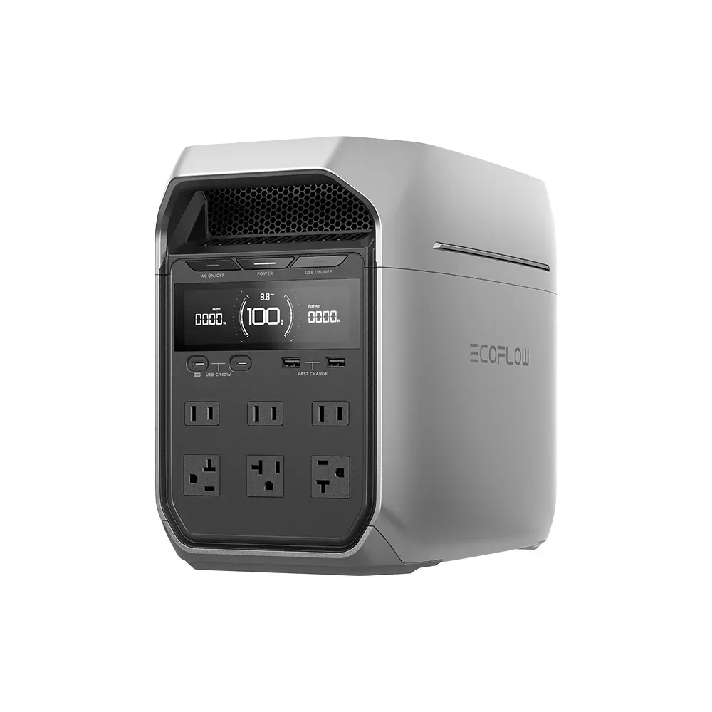
EcoFlow DELTA 3 Plus
Reliable, high-capacity power for RVs, camping, and extended outdoor use.
EcoFlow DELTA 3 Plus
The EcoFlow DELTA 3 Plus provides 4,096 Wh of energy and a 3,000 W output to run RV appliances, campsite gear, and tools for longer periods outdoors. It recharges quickly from AC, solar, or vehicle input, making it easy to keep powered during extended trips. With UPS support, it can also protect essential devices during short home outages. Durable and versatile, it fits well into RV setups, basecamp power, or mobile work environments.

EcoFlow DELTA 3 Plus with 2x 110W Solar Panel
High-capacity outdoor power with portable solar charging for RVs, camping, and off-grid stays.
EcoFlow DELTA 3 Plus with 2x 110W Solar Panel
This bundle pairs the 4,096 Wh DELTA 3 Plus with two 110 W foldable solar panels for clean, portable energy during camping trips, RV travel, or extended time off-grid. Its 3,000 W output supports key appliances, lights, cooking gear, and tools, while the solar panels help maintain charge when shore power isn't available. Easy to set up in campsites or outdoor spaces, the system also provides short-term backup at home when the power goes out. A flexible and reliable energy solution for life outdoors.

EcoFlow DELTA 3 Max with 400W Solar Panel
High-capacity outdoor power with fast, portable solar charging for RVs and camping.
EcoFlow DELTA 3 Max with 400W Solar Panel
The EcoFlow DELTA 3 Max provides 2,048Wh of power and a 2,400W output (up to 3,400W with X-Boost) to run RV appliances, cooking gear, lights, and tools at camp. Paired with a 400W solar panel, it recharges easily when you're off-grid or away from hookups. The system also supports quick AC and vehicle charging for use on the move. Reliable and easy to set up, it offers steady power for outdoor trips and short home outages alike.
EcoFlow DELTA Pro 3
Reliable home backup power with strong output and expandable capacity for outages, whole-home support, and flexible use.
EcoFlow DELTA Pro 3
The EcoFlow DELTA Pro 3 delivers reliable backup power with a 4,096 Wh battery and a 4,000 W output that can run major home appliances during outages. It can expand up to ~12 kWh with additional smart batteries for longer runtimes and greater home coverage. With multiple charging options and quiet operation, it's ready when you need it most. Despite its robust performance, it stays portable enough to use for RVing, camping, or on-the-go power needs.
EcoFlow DELTA Pro 3 with 400W Solar Panel
Powerful outage backup with renewable solar charging and expandable energy storage.
EcoFlow DELTA Pro 3 with 400W Solar Panel
This bundle pairs the 4,096 Wh DELTA Pro 3 with a 400 W solar panel for dependable backup power and sustainable recharging during outages. Its 4,000 W output powers essential loads, and the solar panel helps keep the station charged when the grid is down. The system can expand up to ~12 kWh with extra batteries, offering broader home-backup coverage. The lightweight panel also adds flexibility for RVing, camping, and off-grid use.

5% OFF
BEREADY5
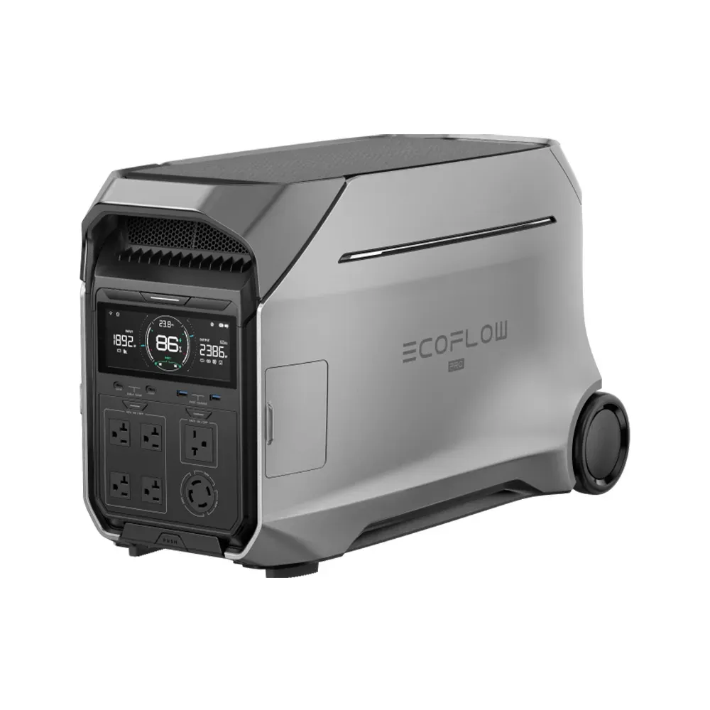
EcoFlow DELTA Pro Ultra
Whole-home backup with powerful output, smart energy management, and expandable storage.
EcoFlow DELTA Pro Ultra
The EcoFlow DELTA Pro Ultra delivers whole-home backup with a 6 kWh battery and up to 6,900 W output—enough to run central appliances, HVAC systems, and high-demand tools. It's designed for seamless home integration and reliable performance during outages, with smart energy controls that keep essential circuits online. The modular system can expand as your needs grow and works within the larger EcoFlow ecosystem for full-home energy independence.
Not Sure Where to Start?
Reach out to our team of experts and get the help you need to choose the right gear for you.
Why Buy from Satellite Phone Store

10,000+ Verified 5-Star Reviews
Rated 5 stars by thousands of customers worldwide—trusted for reliable satellite gear and service.
See reviews
Nearly Two Decades of Expertise
Serving customers since 2006 with deep experience in satellite phones, data, and connectivity solutions.

Industry-Leading Product Selection
Shop the largest in-stock assortment of satellite phones, terminals, hotspots, and accessories.

Plans That Work Anywhere
Local, regional, and global airtime options available for travel, enterprise, and emergency use.
7-Day Expert Support
Get help from real satellite specialists—available every day to answer questions and assist after purchase.

Fast & Priority Shipping Options
Need it quickly? We offer expedited and same-day delivery options on eligible orders.
How People Use Satellite Devices

Emergency Preparedness & Disaster Response
Remote Work & Off-Grid Operations

Travel, Adventure & Exploration

Maritime & Offshore Use

Industrial, Construction & Field Services

Fleet Management & Mobile Operations
Remote Work & Off-Grid Operations
Stay Connected Wherever Work Takes You
Satellite devices provide reliable voice and internet connectivity for professionals and teams operating beyond cellular coverage — from remote job sites and field offices to fully off-grid work environments.
Explore Satellite Solutions:
- Satellite Phones — reliable voice and SMS for coordination and backup
- Starlink Satellite Internet — high-speed connectivity for remote offices and team workflows
- Satellite Wi-Fi Hotspots — lightweight data access for individual or temporary setups
Travel, Adventure & Exploration
Communication Beyond Cellular Networks
For overland travel, expeditions, and remote destinations, satellite devices help travelers stay connected, informed, and prepared when traditional networks are unavailable.
Explore Satellite Solutions:
- Satellite Phones — off-grid voice and text communication
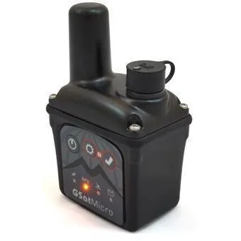
- Satellite GPS Trackers — SOS, location sharing, and safety monitoring
- Satellite Wi-Fi Hotspots — portable internet access for travel and expeditions
Maritime & Offshore Use
Reliable Connectivity at Sea
Satellite communication solutions designed for vessels and offshore operations deliver dependable voice, data, and tracking coverage across open water and coastal regions.
Explore Satellite Solutions:
- Satellite Phones — global voice communication at sea
- Maritime Terminals — dedicated satellite systems for vessels and offshore platforms
- Starlink Internet — high-speed connectivity for crews, operations, and onboard systems
Emergency Preparedness & Disaster Response
Be Ready When Networks Go Down
Satellite communication solutions enable critical voice and data connectivity during emergencies, natural disasters, and infrastructure outages — when cellular networks, power, and terrestrial systems are unavailable or unreliable.
Explore Satellite Solutions:
- Satellite Phones — reliable voice and SMS for emergency coordination
- BGAN Terminals — portable data connectivity for response teams and command posts
- Starlink Satellite Internet — high-speed broadband for recovery operations and temporary facilities
Industrial, Construction & Field Services
Communication Built for Demanding Environments
Rugged satellite solutions support operations across construction, energy, mining, and infrastructure projects where reliable communication is essential for safety, coordination, and uptime.
Explore Satellite Solutions:
- Satellite Phones — reliable voice and SMS for field crews and supervisors
- Starlink Satellite Internet — high-speed connectivity for job sites, temporary offices, and mobile operations
- OneWeb Satellite Internet — enterprise-grade connectivity for large-scale deployments and critical infrastructure
Fleet Management & Mobile Operations
Reliable Communication for Vehicles and Distributed Teams
Satellite communication solutions support fleet operators, mobile teams, and vehicle-based operations with dependable voice, data, and group communication — even beyond cellular coverage and fixed infrastructure.
Explore Satellite Solutions:
- Satellite Phones — remote voice & text communication
- Satellite Wi-Fi Hotspots — instant one-to-many team communication
- Starlink Satellite Internet — vehicular use and mobile broadband connectivity
Recommended Satellite Solutions:
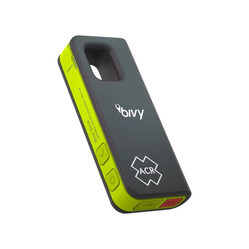
ACR Bivy Stick
Compact, global 2-way satellite texting with unlimited messaging and 100% Iridium coverage.
Iridium Extreme 9575 Satellite Phone
Most durable & reliable connectivity with an emergency SOS, for secure & critical communication.
Iridium 9555 Satellite Phone
Robust connectivity in varying conditions, when reliability & secure access are needed most.
Inmarsat IsatPhone 2
Dependable satellite connection for clear skies, when cellular fails & privacy is key.
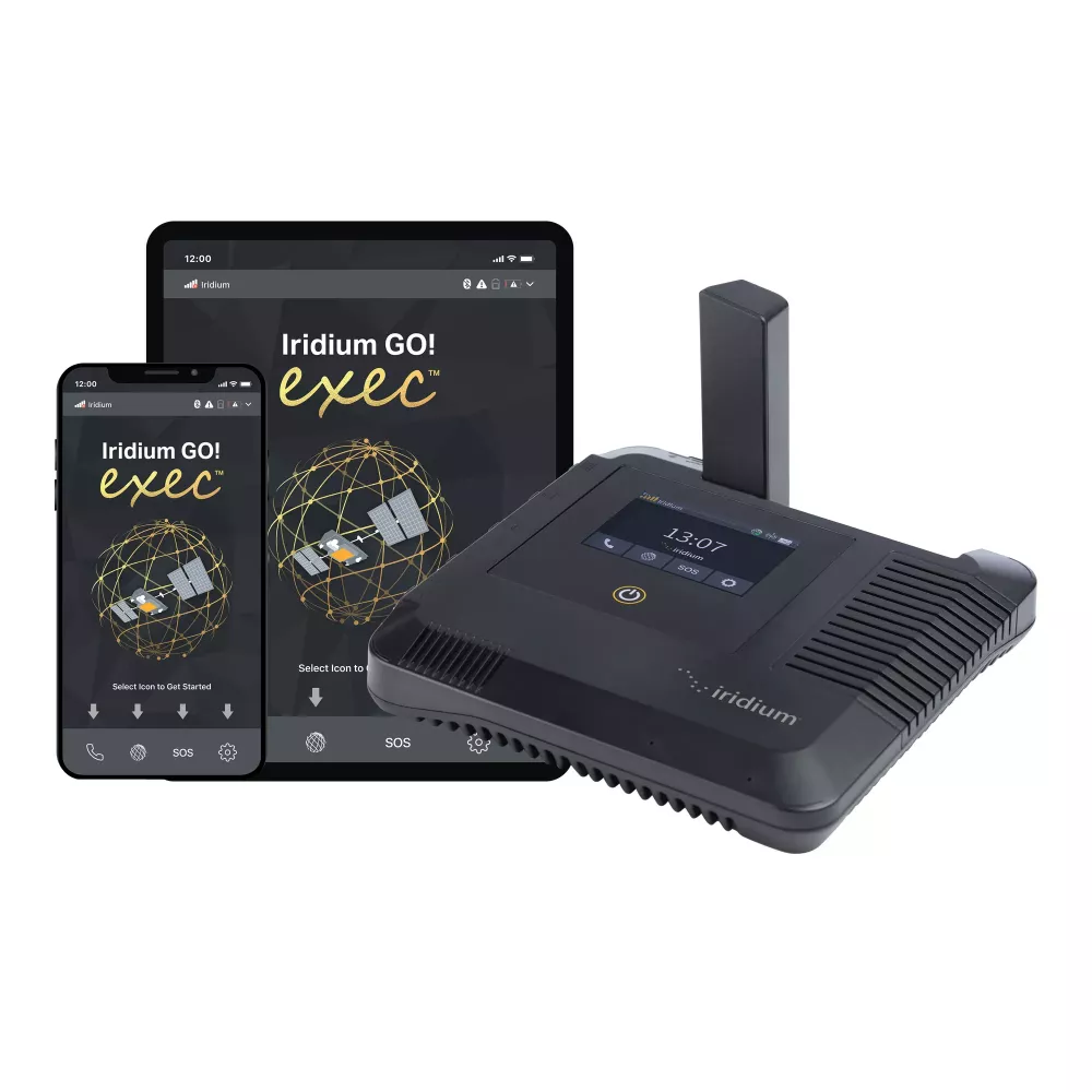
Iridium GO! Exec
Portable, battery-powered, unlimited data. Turn your smartphone into a satellite hotspot with text, voice, email, and SOS.
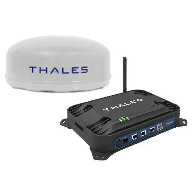
Iridium Certus Thales VesseLINK 700
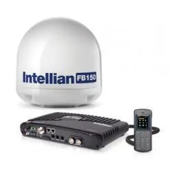
Global maritime terminal with 700 kbps data and three voice lines for reliable ship-to-shore communications.
Starlink Standard
Reliable satellite internet designed for stationary use with travel-ready flexibility—a great alternative to traditional internet solutions.
Starlink Mini
Ultra-portable USB-C powered satellite terminal with a lower power draw and built-in Wi-Fi, ideal for quick deployments and simple transport.
Starlink Performance
Most rugged and reliable Starlink designed for critical uptime, vehicular and maritime usage, and extreme weather conditions.
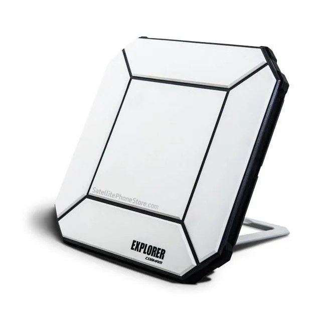
Cobham Explorer 510 BGAN Terminal
Compact BGAN terminal offering portable broadband up to 464 kbps with Wi-Fi for multiple devices.
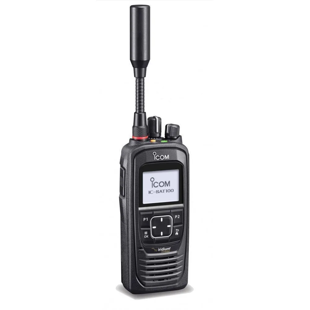
ICOM IC-SAT100 PTT Iridium Satellite Radio
Instant, secure Push-to-Talk over Iridium — one-to-many team comms anywhere on Earth.
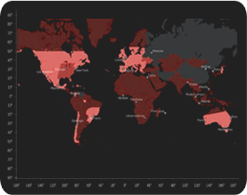
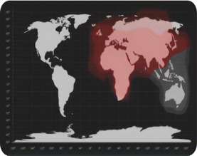
Compare Top 4 Brand Coverage Maps

 Inmarsat Coverage Map
Customer Testimonials
Salvatore
December 3 2023, Wyoming
Peace of Mind
I purchased four sat phones for my family which gives my wife and I peace of mind in this increasingly chaotic world. Haven't used them yet but will be using soon.
T I.
August 10 2025, FloridaReceived item quickly. Great customer service from the purchase to my many questions about the Starlink Mini. Very satisfied.
A R.
July 21 2025, CaliforniaYou guys were great and extremely helpful when it came to setting up the starlink mini and helping me with any questions i may have had.
Benjamin B.
July 14 2025, NebraskaEasy experience purchasing Starlink with these guys. Great explanation of the equipment.
Billy A.
September 13 2025, OklahomaSuper happy that the phone extra battery and charge cord plus carrying case arrived extremely fast. The satellite phone worked great and gave us peace of mind where there was no cell service available.
Sharon H.
October 1 2024I purchased a Faraday bag for my cell phone. Basically to put in while I sleep and I've seen improvement. It stopped everything when I had it on and it stopped it while in bag. I was surprised at how fast it was delivered too. Kudos!
Lori
November 29 2024Fast delivery response and quality product does exactly safeguards electronic cell phones and IPAD as advertised.
Stephen C.
October 10 2024Very good. the product is just what i wanted (Faraday bag for phone). Quality looks very good. Delivery was prompt. Thanks.
Gil
September 27 2023, WyomingExtremely responsive sales team and a great source of products, plans and accessories! Very pleased with purchase overall.
Derrick R.
April 3 2023It was a deal I couldn't refuse.
Nick T.
September 1 2023, OregonExcellent service got the phone with him two days. The kid in Alaska was awesome.
James A.
September 6 2023, TexasGreat product. Good value. Most accommodating and a very friendly staff.
Kevin T.
October 17 2023Super fast shipping easy to set up call quality excellent.
David K.
January 11 2024, ArizonaThis has been a very valuable tool here in our county as much of the area has no cell service. Used for emergencies.
Kenneth E.
February 12 2024, FloridaGreat phone received it the next day after ordering!
Frequently Asked Questions
If you’re wondering “where do you buy a satellite phone?” or “where can I buy satellite phone accessories?”—you’re in the right place. Satellite Phone Store is a trusted provider of satellite phones for sale, offering both new and certified pre-owned models from top brands.
We carry:
- Iridium Satellite Phones
- Inmarsat Satellite Phones
- Marine satellite phones with waterproof and salt-resistant designs
- Globalstar Satellite Phones
Whether you need a phone for offshore sailing, remote expeditions, or emergency backup, we have the right device and plan for you. You can buy a satellite phone outright or choose from flexible rental options.
Click here to view our satellite phones for saleYou must be outdoors with a clear view of the sky. Buildings, trees, or mountains can block the signal. Once powered on, the phone will search for service and register on the satellite network. After that, you're ready to make and receive calls.
Yes. As long as you have a clear view of the sky and your satellite phone is registered, you’ll have service from virtually anywhere on Earth.
No worries—your phone stays active. If you go over your prepaid minutes, you’ll simply be billed at the standard per-minute rate. We never shut off service or interrupt your connection.
Each rental includes two fully charged batteries. Expect up to 3.5 hours of talk time and 19 hours of standby. If you power the phone on only when needed, a single battery can last up to a week.
Starlink delivers broadband-class speeds, typically ranging from 25 Mbps to 400+ Mbps, depending on the terminal type, service plan, and network conditions. Latency is generally 25–60 ms, supporting real-time applications.
Yes. Starlink supports live streaming, video conferencing, and real-time data applications. Performance varies by terminal and plan, with higher-capacity models such as Starlink Performance better suited for sustained uplink and bandwidth-intensive workflows.
Starlink terminals can be used in stationary, portable, or mobile deployments, depending on the hardware and service configuration. Standard terminals are commonly used at fixed sites, while Starlink Mini and Performance support transportable and mobile use cases. A clear view of the sky is required for optimal operation.